Landmark-enhanced route itineraries for navigation of blind pedestrians in urban environment
Journal on Multimodal User Interfaces 12(3):181-198, 2018
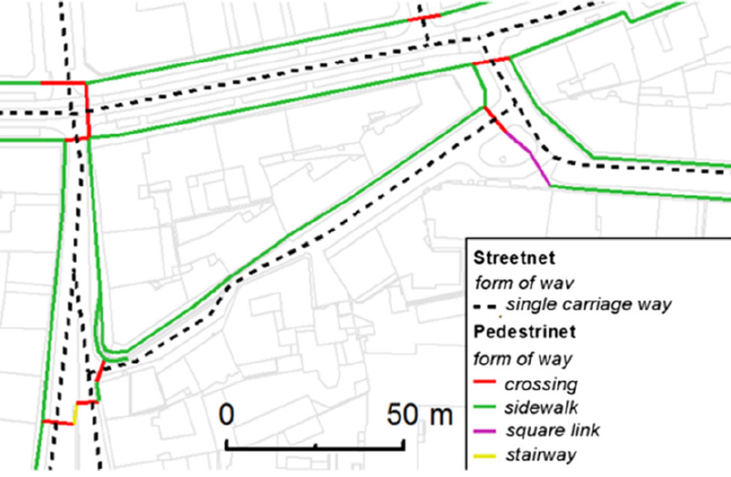
Visual impairment limits a person mainly in the ability to move freely and independently. Even with many navigation aids and tools currently on the market, almost one-third of the visually impaired do not travel alone without a guide. One of the most useful aids are the landmark-enhanced itineraries of the route created by orientation and mobility specialists.We describe the design of a system, which is based on a specific, efficiently collected geographical data, and which automatically generates human-like landmark-enhanced itineraries for navigation of visually impaired users. The studies we conducted (quantitative n = 16, qualitative n = 6) showed usability and efficiency of the system. We also provide a set of design recommendations to increase the usability of the system along with specific examples of usage of particular landmarks. Moreover, we report on 14-day long diary study (n = 3) where visually impaired participants used the system freely throughout the city center with a success rate of 84% without using GPS. Finally, based on an over-the-phone survey (n = 18), we provide a methodology to identify the essential area, where geographical data needs to be collected to enable visually impaired pedestrians to travel around the city center efficiently.
Obrázky